
West Quantoxhead
-

AD0001
A meet of the Quantock Foxhounds at Rydons Farm on the Doniford Road.
-
BD0002
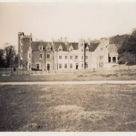
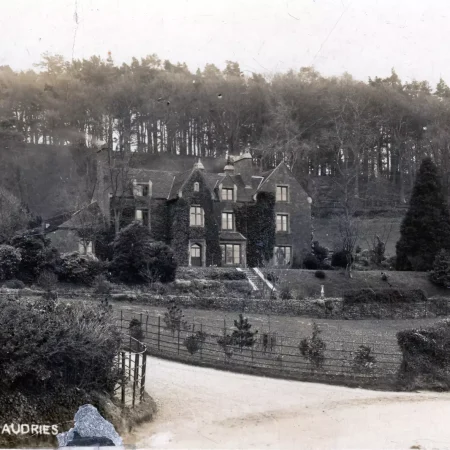
St. Audries House, after it became a school
-

BD0040
‘Rydons Lodge’ on the Doniford Road, looking north west towards Watchet. It was built in memory of Prince Albert and about 30 years after the other lodges.
-
BE0001
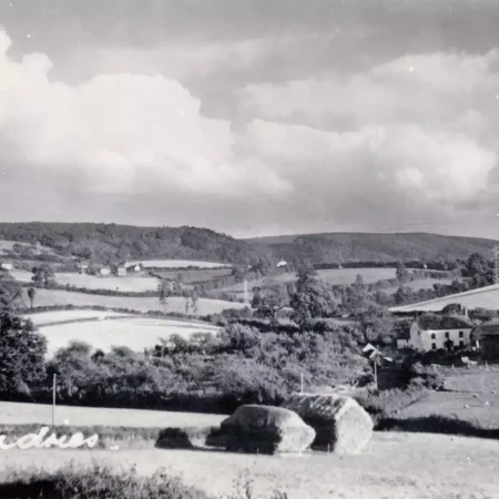
Wibble Farm from the A39. There is now (2018) a large plant nursery to the left of the farm and the farm is almost entirely hidden by trees.
-

BE0002
Staple Farmhouse on the left, looking up Weacombe Road towards The Avenue.
-

BE0003
“Staple Cleeve” on Weacombe Road
-
BE0004
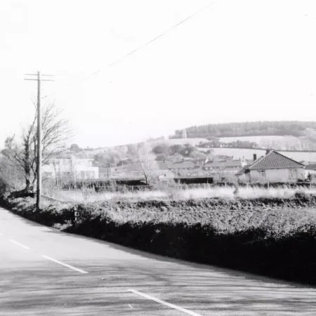
Looking east along the A39 with the petrol station visible beyond the lorry and Staple Plantation on the horizon to the right
-

BE0005
View north along Weacombe Road with “Staple Cleeve” on the right and “Green Acres” to the left
-
BE0006
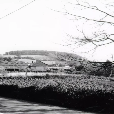
View taken from the A39 near the Doniford Road junction. The corner of the petrol station building can just be seen on the left edge and Staple Plain (with the plantation) is on the horizon.
-

BE0007
A view from the A39 near the Doniford Road junction, towards Staple Plain on the horizon
-

BE0008
Looking west along the A39 with Doniford Road off to the right
-

BE0009
A view from the bottom of Staple Lane looking south east towards Staple Plantation
-

BE0010
Looking east along the A39 towards Kilve. The house in the foreground is now (2018) called “Quantock Haven” and the bicycle is by the gate to “The Orchard”. The garage is about 100metres behind the photographer.…
-

BE0011
Looking east along the A39 towards Kilve. The house in the foreground is now (2018) called “Quantock Haven” and the bungalow to the left is “The Rest”. The garage is about 100 metres behind the photographer.…
-

BE0012
A view of the rear of houses in Staple Lane. Towards the top left corner can be seen a bend in the old Great Road (then the main route to Holford and Bridgwater) which “fell” into…
-

BE0013
A view up Staple Lane towards Staple Plantation.
-

BE0014
St Audries Garage was opened in 1929 by Hebert (Herby) Stone but his business failed in the early 1930s and was then revived by Mr T H Pearce. It was closed in 1940, when it was…
-

BE0015
A view of St Audries. Believed to have been taken from near the top of Staple Lane, towards Minehead in the far distance. The, end-on, white cottage on the right is ‘Mount Royal’ by the Doniford…
-

BE0016
Workers cottages built by the estate at Staple crossroads so that their old cottages, near the church, could be demolished.
-
BE0017
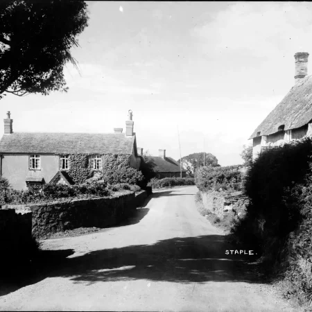
Looking south at the Staple Cross roads (in the distance) in West Quantoxhead.
-

BE0018
A view of Wibble Farm, below the A39 and just outside the village. There is now (2004) a plant nursery next to the farm buildings.
-
CC0006
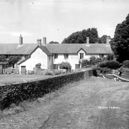
Although Perry Farm appears, geographically, to be in W. Quantoxhead, it is actually in the parish of East Quantoxhead.
-

CC0008
Perry Farm.
-

CE0002
View towards the sea, showing (from the right) St. Audries Church, St Audries House, and the windmill after which the current (2017) pub is named. The main A39 road can be seen left to right.
-
CE0003
The Rectory of St Audries church which is now (2017) just above the A39 on the sharp bend near the top of the drive down to the church.
-

CE0004
View of St Audries House and the Church of St Etheldreda from somewhere just above the Windmill public house.
-

CE0005
A view looking west from West Quantoxhead towards Williton and with North Hill, Minehead on the horizon on the right.
-
CE0007
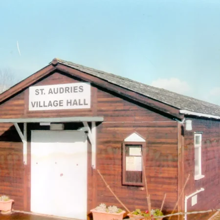
The original village hall at West Quantoxhead, was an old timber-throwers’ hut at Cockercombe, bought for £45 in 1920 and erected nearer to the church. This ‘new’ village hall was opened in 1968 next to the…
-

CE0008
Children playing on the old machinery left when the Vinnicombe Quarry closed. The equipment was later sold by auction at Bishops Lydeard. The quarry started around 1888 and closed in about 1958, although it re-opened briefly…
-
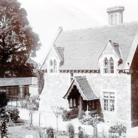
CE0012
The old village school, now “Peregrine House” opposite the Windmill Inn.
-

CE0013
Aerial view of West Quantoxhead and St Audries
-

CE0014
Now (2018) The Windmill Inn, this was a private house with a Tea Room in the garden to the rear. The windmill, which gives the name, can be seen behind the chimney stack.
-
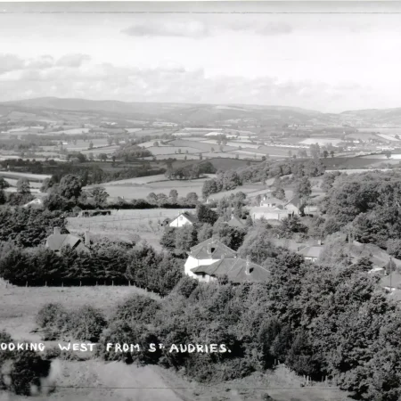
CE0015
Looking west over West Quantoxhead with the A39 just visible by the trees to the right. The cluster of buildings just right of centre and in the middle distance is the garage on the A39. North…
-

CE0020
The “Windmill Guest House” which became the Windmill Inn in 1961. The windmill name was after the wind pump which was/is(2018) behind the building.
-

CE0021
A view from near St Audries church, showing the main road and the “Windmill Guest House”
-

CE0022
A view along the A39 with “Quantock Haven” nearest the camera and the “Windmill Tea Rooms” behind.
-

CE0023
The “Windmill Guest House” which became the Windmill Inn in 1961.
-

CE0024
A bungalow in The Avenue, belived to be ‘Sunnyside’.
-

CE0028
A photograph of the quarry in Vinnicombe. The wall visible in front of the line of trees was alongside the “Great Road” which, before the A39 was built, was the main route from Holford to West…
-

CE0031
A view along the A39 towards Kilve. Taken before the road was widened, the church is down to the left and the rectory is to the right. The small structure on the right was a pigsty.
-

CE0035
A view down The Avenue towards the church, from Staple Crossroads. There are now (2018) houses on both sides of the road.
-

DC0003
A view along the coast with North Hill at Minehead the headland in the distance.